SCARS
This project examines human intervention in the landscape. It explores the marks and transformations resulting from processes driven by self-interest, and offers a critical reflection on the traces these actions leave behind. These traces are understood not only as physical remnants, but as manifestations of power and exploitation, revealing the tensions between progress, environmental impact and memory.
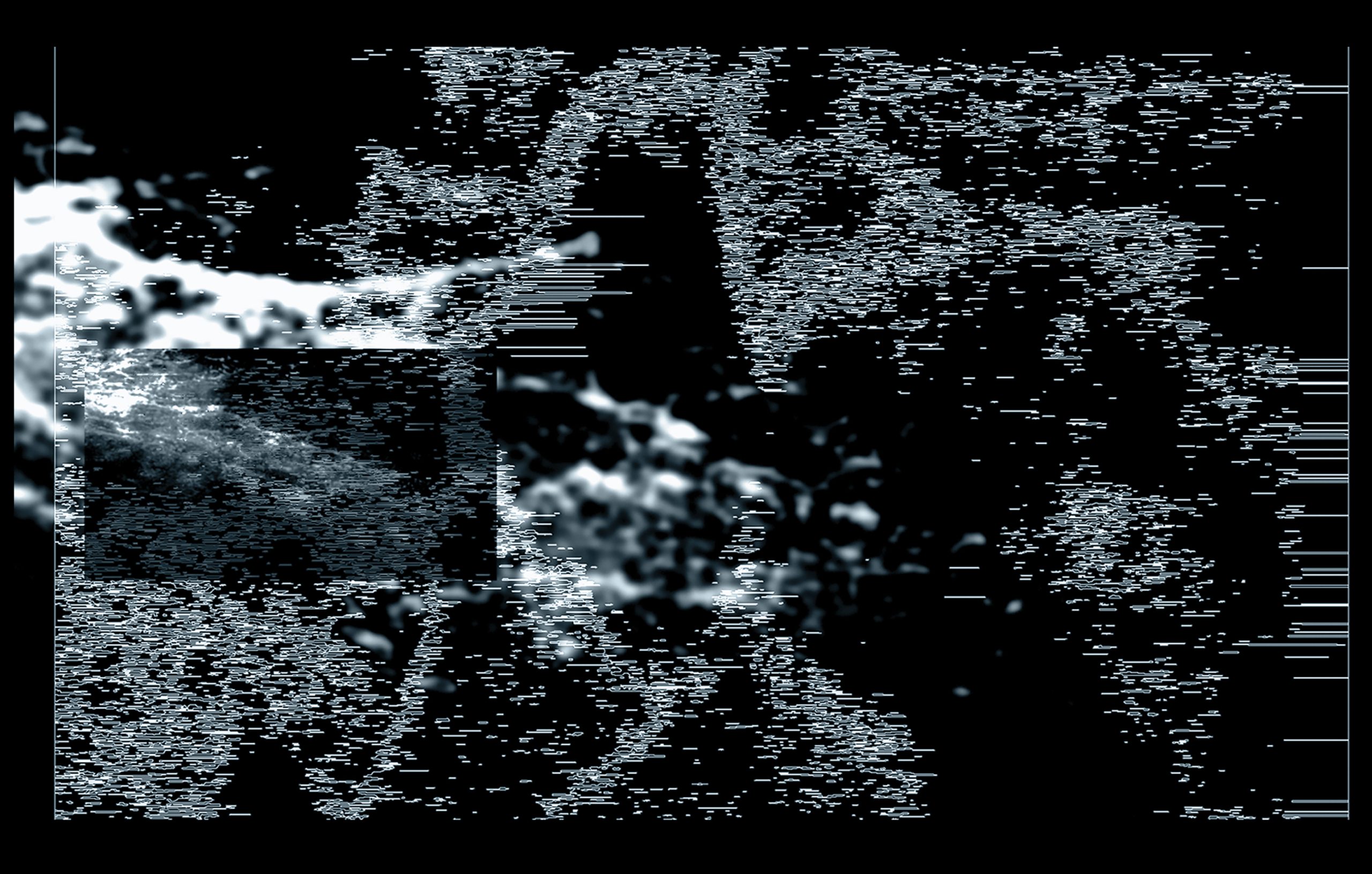
SCARS approaches the relationship with the landscape through two clearly differentiated phases: an initial one, in which the immobility resulting from an accident restricts the experience to the digital domain, and a second one in which physical recovery makes possible a bodily reencounter with the natural environment, revealing two modes of perception of the territory: through the screen and through direct multisensory contact with nature.
SCARS creates space to rethink the sensory experience in relation to the landscape. It is structured around three fundamental axes: human action in the face of nature’s resilience, the different modes of perception —from technological mediation to direct experience— and, centrally, temporality. In contrast to our linear and progressive conception of time, the project foregrounds the cyclical rhythms of nature, inviting the viewer to experience a slower temporality and to recognise the recurring flows that traverse the landscapes.
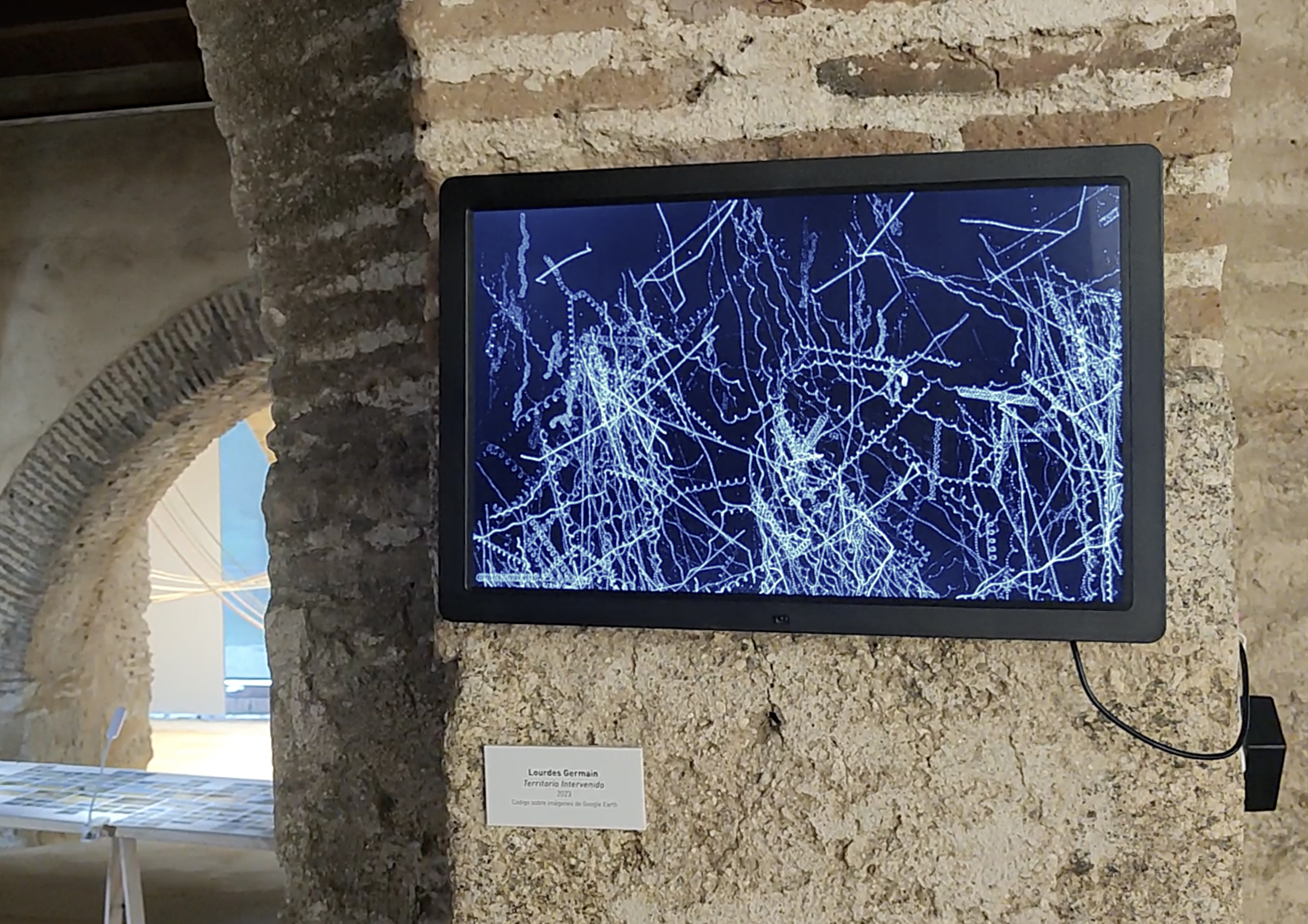
The project adopts an interdisciplinary approach structured around two complementary axes: an analytical one, developed through the creation of "Territorio Intervenido" using open-source code (Processing), and a perceptual one, articulated through audiovisual works that engage with the sensory experience of space and time. These approaches converge to reframe traversed spaces, proposing a layered reading in which data-driven processes, visual narration and subjective perception intersect.
OPEN-SOURCE CODE
TERRITORIO INTERVENIDO 3´16´´ 2023-24
This work focuses on the construction of fictional, unreal maps derived from satellite imagery. Fragments captured from Google Earth are extracted from their original geographic context and reassembled through open-source code, producing cartographies that no longer correspond to any existing territory. By working from the satellite’s detached, totalising gaze, the project interrogates how contemporary technologies of observation generate abstracted, speculative visions of space, where territory becomes data, surface and fiction.
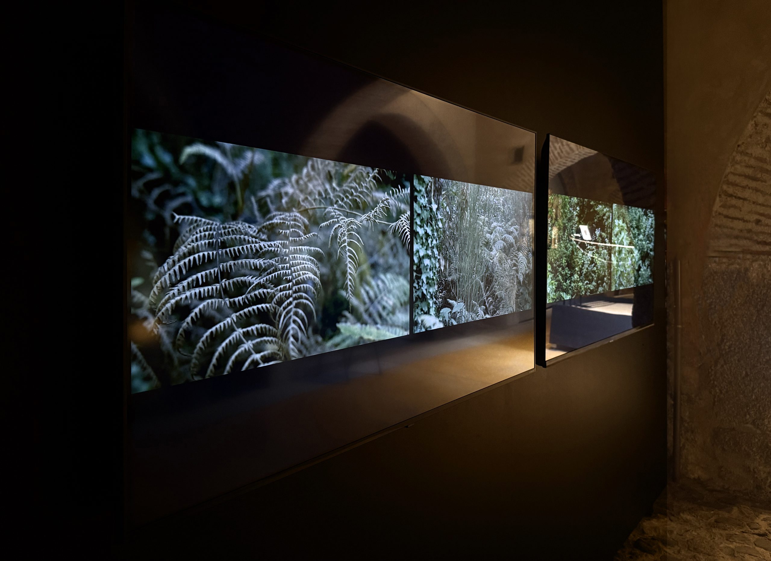
AUDIOVISUAL WORKS
This body of audiovisual works emerges from sensory immersion in reservoirs, forests, and pathways, mapping territories such as Las Hurdes, the Gabriel y Galán Reservoir, and the Vía Verde from Baños de Montemayor to Béjar. These landscapes hold a latent memory shaped by natural disasters, institutional neglect, and historical processes of expropriation, where human and natural forces remain in constant negotiation.
The works are structured as a continuous sonic composition, without a defined beginning or end, evoking a cyclical temporality inherent to natural systems. In contrast to the linear and progressive notions of time associated with contemporary technological and cultural paradigms, the project proposes an experience in which time is suspended, foregrounding a slower and more reflective temporal awareness.
SCARS. HD video with audio. 3´21´´. 2025. BÉJAR_ BAÑOS DE MONTEMAYOR_CASTAÑÁR DE HERVÁS_VÍA VERDE_GRANADILLA
ALMA INMOLATA. HD video with audio. 5' 57''. 2024. LAS HURDES
CONTINUUM. HD video with audio. 6' 21''. 2024. LAS HURDES
AETHERNUS. HD video with audio. 5' 2024. EMBALSE DE GABRIEL Y GALÁN
KATHARSIS. HD video with audio. 5'12''. 2024. MEANDRO MELERO
ALMA SÓLIDA_0. HD video with audio. 4' 47''. 2024. BAÑOS DE MONTEMAYOR_BÉJAR
ALMA SÓLIDA_1. HD video with audio. 4' 47''. 2024. CASTAÑÁR DE HERVÁS